Travel in South Africa – the West Coast


The West Coast
It is a warm and misty day. We decide to explore the West Coast - a region north of Cape Town famed for its tranquil atmosphere and beautiful wild flowers from August to September -
 @ All Cape Accommodation")
Languages spoken in the West Coast, South Africa
Town
| Afrikaans
| English
| Xhosa
| Other
|
|---|---|---|---|---|
Yzerfontein
| 71.5%
| 25.3%
| 1.2%
| 1.9%
|
Darling
| 85.4%
| 6.2%
| 5.7%
| 2.7%
|
Langebaan
| 76.2%
| 19.2%
| 1.3%
| 3.3%
|
Saldanha
| 70.3%
| 7.0%
| 19.6%
| 3.1%
|
Jacobsbaai
| 87.2%
| 11.8%
| 1.0%
| |
Vredenburg
| 68.7%
| 5.0%
| 19.3%
| 7.1%
|
Paternoster
| 82.6%
| 5.7%
| 9.1%
| 1.0%
|
St Helena
| 68.9%
| 3.5%
| 25.7%
| 1.9%
|
Hopefield
| 94.2%
| 3.5%
| 2.3%
|
Wikipedia
Heading for the West Coast, South Africa
From Cape Town, driving north on route R27, we pass the Blouberg (blue mountain) suburbs of Cape Town –
- Milnerton - where the Diep River (Deep River) enters the sea,
- Table View - from where Table Mountain can be seen in all its glory.
- Bloubergstrand – from where Robben Island, only 6.9 km (± 4 miles) to the west, can be seen. Robben Island was employed as a prison for political prisoners since the 17th century. Nelson Mandela spent 18 of his 27 years in this prison.
- Melkbosstrand - the most northern suburb of Cape Town, where the Battle of Blauwberg between the British and the Dutch happened on January 8, 1806. The suburb was named after the milk-bush plants that grow on the dunes – a species of Euphorbiaceae.
6 minutes after Melkbosstrand we pass Koeberg Nuclear Power Station - the only nuclear power station in Africa.
And now we find ourselves in the West Coast National Park. The stretched-out land seems to be semi-desert, like the Karoo, but the vegetation is unique West Coast Strandveld (beach veld) and Langebaan Fynbos/Thicket Mosaic.
"In the Fynbos Biome, Thickets are fascinating dynamic relics of a previous climate regime. It is a dense, woody, semi-succulent and thorny vegetation type with a mosaic of lower growing fine- and broad-leaved shrubs as well as dwarf succulents, herbs and grasses." ~conservation-guidelines/Thicket
Patches of wild flowers remind us that we have just missed the spectacular flower season that turns the western regions of South Africa annually from August to September into a wonderland.


")
Heading for the West Coast Peninsula
Heading for the Cape West Coast Peninsula, we pass some of the tranquil towns that give this region its unique 'South Coast' character -
- Darling – founded in 1853. See more of Darling HERE.
- Yzerfontein (Iron Fountain) - a small harbour town with the longest uninterrupted sandy beach on the South African coastline.
- Churchhaven with all its farmsteads situated in the strip of land between the Atlantic Ocean and the Langebaan Lagoon.
- Langebaan- on the eastern shore of the Langebaan Lagoon, this town is known as the water sport capital of the Western Cape. A fossil footprint called Eve's Footprint dated at ± 117 000 old, was discovered on the banks of the lagoon in 1995. The remains of Africa's only bear, along with the fossils of 200 other species, have also been discovered here. Read tonymac’s article about Eve’s footprints HERE.
The West Coast Peninsula


")

More about Darling, South Africa, and Evita's perron
Click thumbnail to view full-size


The Swartland
Turning inland to Darling, we enter a region known as The Swartland (Black Land), named after an indigenous plant, the Renosterbos (Elytropappus rhinocerotis).
Situated between mountain ranges, The Swartland produces wine, wheat, fruit, olives, and vegetables. The region is also synonymous with sheep farming.
We regret not having enough time to visit some wine cellars and olive farms on the Swartland wine route.


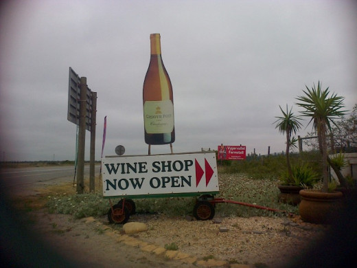
Farm Stall on Route R27
West Coast Peninsula, South Africa
- Saldanha Bay – From Cape Town, Saldana is the first town in the Cape West Coast Peninsula. It has a natural harbor known as the largest and deepest exporting port of ore (iron) in the Southern Hemisphere.
- Jacobsbaai – a beautiful little fisherman’s paradise with a population of ± 420 people.
- Vredenburg – (Peace Town) – Between the farms in the middle of the peninsula this town was established in 1875 as a church town serving members of the Dutch Reformed Church. The town was originally called Twisfontein (Fountain of Strife) due to the disputes between two farmers over the only freshwater spring in the area. The situation got worse and the name was changed to Prosesfontein "Lawsuit Spring". At this stage there was only one church in the region, situated in Hopefield - a bit too far for the local dominee (reverend) to maintain the peace appropriate among Christians. So the authorities decided to build a second church just a cat-spit away from the disputed spring. With a 'Man of God' (the reverend) in their midst, and the 'House of God' guarding the spring, the two farmers came to an agreement and promptly renamed the town to 'Vredenburg'.
- Paternoster – (Latin for ‘Our Father’) - one of the oldest, and most attractive, fishing towns in the West Coast, hosting ± 1,883 inhabitants. Apparently the town derived its name from prayers of ship-wrecked Portuguese sailors. The color-emblem of Paternoster is white and blue with red as an optional decoration. Read more about Paternoster HERE. While taking a short cut on a dirt road, we discover a charming bar/restaurant created with canvas at the entrance of the Cape Columbine Nature Reserve, where the last manned lighthouse in South Africa attracts tourists from from far and near. The Southern Right whales and dolphins roam the ocean in this region ten months of the year.
- Britannia Bay & Shelly Point – New developments in the Cape West Coast Peninsula.
- St. Helena – a major fishing town on the banks of the St. Helena Bay - the bay where the Portuguese explorer, Vasco da Gama, first set foot in South Africa on November 7, 1497.
- Laaiklip & Velddrif – While Laaiplek (Loading Place) is another port in the St Helena Bay, Velddrif is right next door at the mouth of the Bergrivier (Mountain River).
 in the Southern Hemisphere")


We have a late lunch on the banks of the Berg (mountain) River

Hopefield
On our way back to Cape Town we take a quick look at Hopefield, the oldest town in the West Coast originally established in 1844 as a Dutch Reformed congregation. Evidently it was a magnet to traders of all sorts and in 1852 the first residential stands were surveyed by Mr. Hope and Mr. Field. Situated on the banks of the Zoute River, this town was the capital of the West Coast until Route R27 became the main road between the coastal towns.
Human artefacts at the archaeological site near Hopefielf (Elandsfontein) prove the existence of humans in this region between 75 000 to 150 000 years ago.

Tomorrow we will travel from from Cape Town to Mussel Bay -
- Travelling in South Africa – From Cape Town to Mos...
A Picture tour from Cape Town to Mossel Bay, South Africa
More picture tours of South Africa
I am presenting this picture tour of the Cape Province in phases. In order to enjoy the entire tour, the reader should start at Phase 1 -
Phase 1 - From the North West Province via Free State to Matjiesfontein in the Northern Cape.
Phase 2 - From Northern Cape (Matjiesfontein) to Western Cape (Strand)
Phase 3 - The Cape Winelands, Stellenbosch, wine tasting and strawberries (Western Cape)
Phase 4 - Cape-Peninsula (eastern side) Muizenberg to Cape Point
Phase 5 - Cape Peninsula (western side) Cape-Point-to-Sea-Point
Phase 6 – Cape Town
Phase 7 - This article - The West Coast, South Africa
© Martie Coetser
Published: October 2014
Updated: November 2015


 - The San People")
 - The Khoi People")